
Description
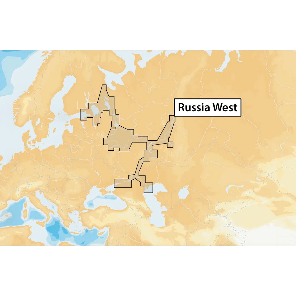
Russia West – microSD™
Navionics+ provides more marine and lakes content and the best value!
Charts – Everything on one card! Nautical Chart, SonarChart™ and Community Edits.
SonarChart™ – Enjoy the exclusive high definition layer and upload your sonar logs to build even better local charts for your area.
Freshest Data – Take advantage of daily updates. Download Freshest Data free for one year!
Coverage:
Baltic Sea to Rybinsk. Estonia, Lake Peipsi, Lake Ladoga, River Svir, Lake Onega, Belomorsko-Baltiyskiy Channel Rybinsk Waterstorage, Volga river.
Kama River, Volga River, Volgo-Donskoy Channel, Black Sea, Sea of Asov, Volga-Don Channel, Don, Dnieper River mouth. Volga river from Nizhny to south side up to Balakovo. Kama river from Kazan to north side up to Solikamsk and Belaya river from Agidel to Ufa.
This product may not be returned to the original point of purchase.Please contact the manufacturer directly with any issues or concerns.
Issued by Maptech Navionics Fishing Maps, the boating and fishing destinations are arranged on water-proof, tear-proof and oil-proof paper maps with High -…!!!!—-
PRODUCT ID: 60549
SKU: NVN-60549
CSKU: CWR-60549
REWRITE: 71660-navionics-russia-west-microsd
MPN: MSD/NAV+52XG/ROW
UPC:
ASIN:
WSKU:
SSKU:
KSKU:
GSKU:
MSKU:
LSKU:
NAME: Navionics+ Russia West – microSD™
NAME_EX: NAVIONICS 52XG RUSSIA WEST NAV+ MSD FORMAT
PTITLE: Navionics+ Russia West – microSD™
TYPE: Cartography | Navionics + ROW
VENDOR: Navionics
Google Category: SOFTWARE > COMPUTER SOFTWARE > GPS MAP DATA & SOFTWARE
Amazon Category:
Amazon Title:
Google Title: Navionics MSD/NAV+SO Navionics+ South
Amazon Category:
Gtags:
| Marine |
GSpecs: