Furuno SC70 Satellite Compass w/o Cable
Original price was: $5,395.00.$299.99Current price is: $299.99.

Description
SC70 Satellite Compass w/o Cable
The SC70 is the latest satellite compass built on FURUNO’s commercial-grade technology platform. These satellite compasses prove their value by increasing the accuracy of other devices, such as Radar, ARPA, Scanning Sonar, Current Indicator, Chart Plotter, ECDIS and Autopilots. They provide a highly accurate heading input to these other technologies by utilizing the very latest GNSS (Global Navigation Satellite System). This satellite system is comprised of GPS, Galileo and GLONASS to ensure the highest precision and a continuous coverage.
The SC70 provides a variety of data, including GPS Positioning, SOG (Speed Over Ground), COG (Course Over Ground), ROT (Rate Of Turn) and 3-axis speed (bow, stern and longitudinal). All of these data assist with critical maneuvers, such as berthing. The compasses is maintenance free – a great asset for any vessel.
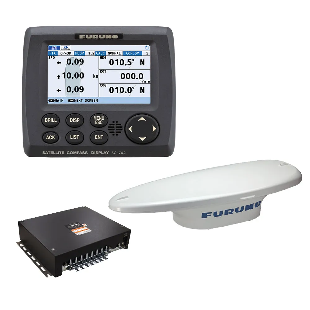
Consists Of:
- SC701 – Junction box for SC70/SC130
- SC702 – Display unit for SC70/SC130
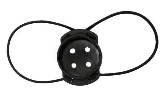
- SC703 – ANT 2GPS/ANG/ACCEL/MGNT SNSR
Note: The SC70 and SC130 are sold without an antenna cable.
Standard Features:
- Provides highly accurate heading data of 0.4° for autopilot, Radar, ARPA, Scanning Sonar, Current Indicator, Chart Plotter, ECDIS and Autopilots
- Ideal for small to medium boats requiring highly accurate heading
- Utilizes GNSS such as GPS, Galileo and GLONASS for high Precision
- SBAS compatible (EGNOS,WAAS,MSAS)
- Provide precise data for SOG, COG, ROT and L/L
- Eliminating the problem of not having enough satellites at hand by using multiple types of satellites
- Speed on 3 axis (bow, stern and longitudinal) for safe navigating and berthing
- IMO Type-approved as THD, GPS and ROTI. Complying with the IEC, ISO requirements
- Easily integrated into the existing shipboard network via Ethernet
- Rapid follow-up rate 40°/s (twice the IMO high speed craft requirement, 20°/s)
- Maintenance free and no recurring cost as there are no mechanical parts
- Super short starting time – 90 seconds
- Once the power is on, it takes about 90 seconds to start (the starting time will slightly differ depending on the equipment location)
- Easy to retrofit by using existing antenna cabling for SC-50/55/60/110/120. (The LAN_CNV option kit is necessary)
- Precision pitch/roll data in Analog and Digital formats for vessel stabilization, Sonar, etc.
This product may not be returned to the original point of purchase.Please contact the manufacturer directly with any issues or concerns.
Furuno SC70 Satellite Compass
Model: SC70
- Provides highly accurate heading data of 0.4° for autopilot, Radar, ARPA, Scanning Sonar, Current Indicator, Chart Plotter, ECDIS and Autopilots
- Ideal for small to medium boats requiring highly accurate heading
- Utilizes GNSS such as GPS, Galileo and GLONASS for high Precision
- SBAS compatible (EGNOS,WAAS,MSAS)
- Provide precise data for SOG, COG, ROT and L/L
- Eliminating the problem of not having enough satellites at hand by using multiple types of satellites
- Speed on 3 axis (bow, stern and longitudinal) for safe navigating and berthing
- IMO Type-approved as THD, GPS and ROTI. Complying with the IEC, ISO requirements
- Easily integrated into the existing shipboard network via Ethernet
- Rapid follow-up rate 40°/s (twice the IMO high speed craft requirement, 20°/s)
- Maintenance free and no recurring cost as there are no mechanical parts
- Super short starting time – 90 seconds
- Once the power is on, it takes about 90 seconds to start (the starting time will slightly differ depending on the equipment location)
- Easy to retrofit by using existing antenna cabling for SC-50/55/60/110/120. (The LAN_CNV option kit is necessary)
- Precision pitch/roll data in Analog and Digital formats for vessel stabilization, Sonar, etc.
The SC70 is the latest satellite compass built on FURUNO’s commercial-grade technology platform. These satellite compasses prove their value by increasing the accuracy of other devices, such as Radar, ARPA, Scanning Sonar, Current Indicator, Chart Plotter, ECDIS and Autopilots. They provide a highly accurate heading input to these other technologies by utilizing the very latest GNSS (Global Navigation Satellite System). This satellite system is comprised of GPS, Galileo and GLONASS to ensure the highest precision and a continuous coverage.
The SC70 provides a variety of data, including GPS Positioning, SOG (Speed Over Ground), COG (Course Over Ground), ROT (Rate Of Turn) and 3-axis speed (bow, stern and longitudinal). All of these data assist with critical maneuvers, such as berthing. The compasses is maintenance free – a great asset for any vessel.
What’s in the Box:
- Box 1- SC701 Junction Box
- Box 2 – SC702 Display
- Box 3 – SC703 Antenna Unit
SC70 satellite compass without cable SC70 is the latest satellite compass built on Furuno’s commercial-grade technology platform. These satellite compasses prove their value by improving the accuracy of other equipment,…!!!!—-
PRODUCT ID: 66667
SKU: NVN-66667
CSKU: CWR-66667
REWRITE: 77778-furuno-sc70-satellite-compass-w-o-cable
MPN: SC70
UPC:
ASIN:
WSKU: FURSC70
SSKU:
KSKU:
GSKU:
MSKU:
LSKU:
NAME: Furuno SC70 Satellite Compass w/o Cable
NAME_EX: FURUNO SC70 SATELLITE COMPASS W/O CABLE
PTITLE: Furuno SC70 Satellite Compass w/o Cable
TYPE: Marine Navigation & Instruments | Compasses
VENDOR: Furuno
Google Category: ELECTRONICS > MARINE ELECTRONICS
Amazon Category:
Amazon Title:
Google Title: Furuno 12″ NavNet TZtouch2 Doppler Radar Bundle [TZTL12F-NXT]
Amazon Category:
Gtags:
| Furuno |
GSpecs: